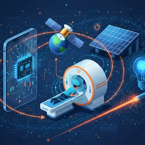
Wildlife conservation has always been a race. But in 2026 it feels like the track got longer, the weather got worse, and the people running the race are still asked to do it with the same worn-out shoes. At this critical juncture, AI in wildlife conservation is becoming an indispensable ally. With an unprecedented volume of data flooding in—from millions of camera trap images and thousands of hours of forest audio to satellite updates, drone surveys, ranger notes, and community reports—human teams alone cannot keep up.
AI is not a magic fix for biodiversity loss. But it is starting to do something that matters a ton in the real world: it turns overwhelming streams of messy conservation data into usable decisions faster. Sometimes fast enough to prevent damage instead of just documenting it later.
Why wildlife conservation needs AI now (and why 2026 feels different)
The pressures are stacking up.
Habitat loss is still moving fast, especially around roads, farms, mining, and expanding settlements. Climate change is pushing range shifts in a way that makes “protected area boundaries” feel kind of… old fashioned. Wildlife crime is adaptive and organized. And most field teams are chronically underfunded, understaffed, and expected to cover absurdly large landscapes.
So what is different by 2026?
A bunch of practical things changed at once:
- Cheaper sensors: better camera traps, more rugged acoustic recorders, longer battery life. More units per dollar, which changes what monitoring even looks like.
- Better satellite revisit rates: “near real time” has become more real for many places, especially when you combine multiple satellite sources.
- Edge AI on devices: models can run directly on camera traps and acoustic sensors, filtering junk before it ever touches a cellular network.
- Multimodal models: systems that can combine images + audio + text (like ranger notes) into one signal instead of three disconnected tools.
- Improved low-connectivity deployment: store-and-forward workflows, offline dashboards, intermittent sync. This sounds boring but it is the difference between a pilot project and something rangers actually use.
Reader promise, plainly: this article is about the practical ways AI is being used in 2026 to detect threats earlier, monitor populations more accurately, and stretch limited conservation budgets.
And one boundary that matters. AI supports field teams. It does not replace ecological expertise, Indigenous and community-led stewardship, or the political work of protecting land and water. If someone sells it that way, that is usually a warning sign.
What “AI in wildlife conservation” actually means (in plain English)
When people say “AI for conservation,” they usually mean a stack of three things:
1) Data collection
Where the raw signals come from:
- Camera traps
- Drones (RGB and thermal)
- Satellites
- Passive acoustic recorders
- GPS collars and tags
- eDNA sampling (environmental DNA in water/soil)
- Citizen science photos and checklists
2) Modeling
Machine learning models that turn raw signals into predictions, like:
- “This is a leopard.”
- “This sounds like chainsaws.”
- “Forest loss likely occurred in this grid cell this week.”
- “This elephant movement pattern looks abnormal.”
Here, it’s important to note that adversarial machine learning, a subfield of machine learning, can also play a role in enhancing these predictive models by making them more robust against adversarial inputs.
3) Action
Where it becomes conservation, not just analytics:
- Alerts to ranger teams
- Patrol planning maps
- Habitat restoration targeting
- Corridor decisions
- Impact evaluation (what changed after an intervention)
A few quick glossary-style clarifications:
- Machine learning (ML): algorithms that learn patterns from data to make predictions.
- Deep learning: a type of ML (often neural networks) that’s especially good with images and audio.
- Computer vision: ML for images and video. Common in camera trap work.
- Bioacoustics: ML for animal calls and soundscapes, plus threat sounds like gunshots.
- Remote sensing: satellites (and sometimes aerial imagery) used to monitor land and water.
- Anomaly detection: “this pattern is weird compared to normal,” used for distress signals, illegal activity, sudden habitat changes.
- Predictive modeling: forecasting risk hotspots or likely species presence based on drivers.
The important part is mapping outputs to decisions. AI can produce:
- Presence or absence (did the species show up?)
- Abundance estimates (how many, and how is it changing?)
- Movement corridors (where animals move through the landscape)
- Threat hotspots (where poaching/logging is likely)
- Intervention impact (did we actually reduce incursions, or are we just busy?)
Also, field reality: good enough + fast often beats perfect + slow. If an acoustic sensor flags a likely chainsaw event with 85 percent confidence and rangers can respond within hours, that may save more forest than a 99 percent perfect model that delivers results two weeks later.
In addition to these practical applications, it’s also worth noting that AI’s role in wildlife conservation extends beyond just data analysis and action. It can also be utilized as an educational tool. For instance, platforms offering science quizzes can help raise awareness about wildlife conservation issues by providing interactive learning experiences.
The core conservation problems AI is helping solve
This is the simplest way I know to explain why AI is showing up everywhere in conservation now.
The monitoring problem
Counting animals is expensive, slow, and often invasive. AI speeds up identification, reduces manual review, and helps detect trends earlier.
The detection problem
Illegal logging and poaching often go unnoticed until after the fact. AI can flag anomalies from sound, imagery, and movement patterns so teams can respond sooner.
The prioritization problem
Rangers and funds are limited. AI helps allocate patrols, cameras, and restoration work where it is most likely to matter.
The evaluation problem
A painful truth: lots of interventions are not measured well. AI makes before/after comparisons across large areas more feasible, so projects can learn and adapt instead of repeating habits.
AI animal tracking in 2026: from collars to computer vision
“Tracking” used to mostly mean collars. And collars are still hugely important for some questions, especially movement ecology and human-wildlife conflict.
But by 2026 tracking is a bigger menu:
- GPS or satellite collars and tags
- Camera traps
- Drones
- Satellite imagery
- Citizen science photos (and sometimes even social media, handled carefully)
- Acoustics for species that call reliably
- eDNA for presence in rivers, lakes, coastal zones
Where AI changes the game is reducing manual labor:
- Automatic species ID from camera trap images
- Individual re-identification using coat patterns, stripes, spots, scars
- Behavior classification (feeding, running, resting, social interactions)
- Movement segmentation from GPS time series (normal movement vs sudden stop patterns)
And a big 2026 shift: edge AI.
Instead of transmitting everything, some camera traps and acoustic devices can run lightweight models on-device to:
- filter empty frames
- compress and prioritize “high value” clips
- send alerts via low bandwidth systems
- store locally and sync when a ranger team passes by
That means less battery drain, less bandwidth cost, and fewer “we collected data but can’t move it” failures.
Trade-offs still exist:
- Collars can be expensive and involve animal stress and veterinary risk.
- Vision and audio approaches are less invasive, but biased toward detectable species and accessible habitats.
- Some animals live under canopy, in burrows, underwater, or they are simply too rare to get enough examples quickly.
A concrete example flow (what this looks like in practice):
Camera trap → AI filters empty frames → species or individual ID → dashboard trendline and map → ranger or biologist action (move cameras, target patrols, anti-snare sweep, corridor planning)

The success of these AI applications largely hinges on effective MLOps, which involves deploying and maintaining AI models with a scientific approach.
Camera traps + computer vision: the biggest time-saver
Camera traps create a weird kind of suffering for conservation teams. Not the cameras themselves. The folders. Endless folders.
Computer vision models typically do three things:
- detect animals in an image
- classify species
- sometimes estimate age/sex, group size, or behavior (depends on data quality)
Individual re-ID is where things get really interesting for certain species. Tigers, leopards, zebras, giraffes, whale sharks. Anything with consistent patterns or markings.
This is where Named Entity Recognition comes into play. It helps AI systems to not only identify individual animals but also understand their unique characteristics better.
Why it matters: population estimates and survival rates often depend on identifying individuals over time. If AI can reliably match individuals, it accelerates mark-recapture style analyses and reduces human error from fatigue.
Humans stay in the loop, ideally like this:
- the model labels high-confidence images automatically
- uncertain cases are queued for review
- corrections are saved as new training data
- the model is updated periodically with local examples
Practical tips (because these are the boring things that determine success):
- Placement beats model quality more often than people admit. Bad angles create bad data.
- Lighting and vegetation motion cause false triggers. AI can filter empty frames, but you still want fewer empty frames in the first place.
- Distance to trail matters. Too close and you get partial bodies. Too far and you get blobs.
- Keep metadata. Location, time, habitat type, camera settings. Missing metadata turns analysis into guessing.
Drones + thermal imaging: fast surveys with fewer blind spots
Drones are not a replacement for boots on the ground, but they can compress time.
Common use cases:
- counting animals in open habitats (grasslands, savannas, beaches)
- locating nests or roost sites (carefully, with permits)
- detecting poachers at night (again, carefully, with governance and safeguards)
- monitoring fires and encroachment
- mapping habitat features after floods or storms
Thermal helps because heat signatures show up in low light. But thermal is not magic either.
Limitations:
- canopy cover hides animals
- hot rocks and sun-baked ground can confuse detections
- wind, rain, humidity can reduce clarity
- you still need ground verification for anything sensitive
Operational reality matters:
- flight permissions and restricted airspace
- trained pilots and safety protocols
- battery constraints and weather windows
- not disturbing animals, especially nesting birds or marine mammals
AI helps by:
- running onboard object detection so pilots get immediate cues
- automating transect analysis later (counting, mapping, quality checks)
- producing faster reports that teams can act on

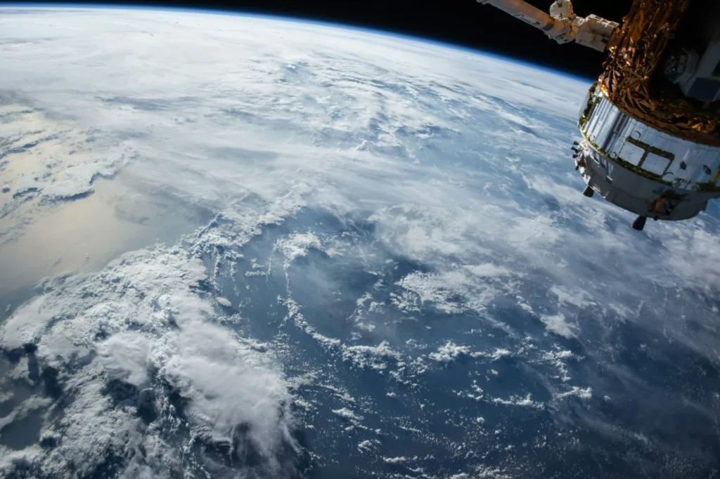
Satellites + AI: protecting habitats at scale
Satellites are the only practical way to monitor huge areas consistently. They are not perfect, but they are relentless.
Remote sensing basics, in normal language:
- land-cover classification: what type of surface is this? forest, water, grassland, built area
- change detection: what changed since last month or last week?
- alerting systems: flag suspicious change so humans can check it
Use cases:
- deforestation and degradation
- mining expansion
- wetland loss
- shoreline change
- wildfire scars and recovery monitoring
- fragmentation metrics (how broken up habitat is)
“Near real time” in practice depends on revisit intervals, clouds, and sensor type. Some areas get frequent updates, other areas are stuck with cloud cover for weeks. False positives happen. Ground verification still matters.
But when it works, satellite + AI connects directly to endangered species outcomes:
- protecting corridors between protected areas
- detecting encroachment near breeding grounds
- monitoring food availability shifts (vegetation, water presence)
- prioritizing restoration where it reconnects fragmented habitat
In addition to these applications, satellite data combined with AI can also be pivotal in addressing environmental issues such as the Great Pacific Garbage Patch, by providing crucial information about plastic pollution in our oceans.
Acoustic monitoring + ML: listening for biodiversity and threats
Passive acoustic monitoring is exactly what it sounds like. You put recorders in the field and they capture soundscapes for weeks or months.
What you can get from sound:
- bird calls, frog choruses, bat echolocation, whale vocalizations
- seasonal patterns (phenology), like when breeding calls start shifting earlier
- biodiversity indices from soundscape structure (with caution)
Threat detection is where it gets urgent:
- gunshots
- chainsaws
- vehicle activity in restricted zones
Anomaly detection models can trigger alerts when something sounds “off” compared to baseline. It is not always about identifying the exact sound, sometimes it is about “this pattern is not normal here at 2:17am.”
Limitations are real:
- noisy environments (wind, rain, rivers, insects)
- overlapping calls
- regional “dialects” in bird calls
- models trained in one forest may perform poorly in another without adaptation
Still, when you have limited patrols, the idea of the forest itself telling you when something is wrong… that is powerful.

Machine learning for biodiversity: turning messy data into population insights
There is a big difference between:
- detecting an animal in a photo
- estimating a population trend you can defend in a report, or in court, or in a policy meeting
Conservation needs the second one, not just the first.
In 2026, a lot of teams are using ecological modeling + ML hybrids, like:
- Occupancy models with ML detections: ML flags species presence in images or audio, then occupancy modeling accounts for imperfect detection.
- Mark–recapture with re-ID: if you can identify individuals reliably, you can estimate abundance and survival more robustly.
- Spatial habitat suitability models: combine detections with environmental layers to estimate where suitable habitat likely exists.
ML also helps with “where to look next”:
- active learning: the model suggests which new samples would improve it most
- identifying under-surveyed areas
- prioritizing transects so field time is not wasted repeating easy spots
Uncertainty matters here. A credible workflow includes:
- confidence intervals
- detection probability assumptions
- transparent thresholds
- documentation of model performance by habitat type and season
Because policy decisions built on overconfident models can backfire badly. And they do.
Predicting where endangered species will be (and where they won’t)
Species distribution models (SDMs) are not new. What AI adds is better pattern extraction and the ability to mix more complex inputs.
Typical drivers:
- climate variables (temperature, rainfall)
- vegetation and productivity
- water availability
- elevation and slope
- human footprint (roads, night lights, land use)
- disturbance layers (fire, logging)
The climate adaptation angle is becoming unavoidable. These models are used to:
- anticipate range shifts
- identify climate refugia (areas likely to stay suitable)
- plan corridors to connect future habitat, not just current habitat
The loop that makes this honest:
Predictions → targeted surveys → model updates → repeat
How to avoid overclaiming:
- SDMs are usually correlational. They do not prove causation.
- interpretability checks matter. If a model says a species “prefers” highways, something is wrong.
- ecological plausibility has to be checked by people who know the species and place
Detecting disease and health stress early
This is one of the most promising, and also one of the hardest areas.
Signals can include:
- unusual movement patterns from GPS (reduced movement, repetitive loops, sudden immobility)
- reduced activity levels over time
- acoustic changes (weaker calls, altered call rates, stress sounds)
- visible symptoms from imagery (body condition, lesions) when resolution allows
Why early detection matters:
- outbreaks can be contained earlier
- targeted treatment or vaccination becomes possible in some cases
- mass mortality risk drops when response is faster
Data challenges are brutal:
- small sample sizes (rare species do not generate big datasets)
- false alarms can waste resources and create panic
- sensitive location data needs strict handling
Field workflow should be cautious:
AI alert → veterinarian/biologist review → verification (often on the ground) → intervention if warranted
Incorporating blue carbon ecosystems like mangroves and seagrasses into these models could also play a significant role in climate adaptation strategies. These ecosystems not only provide critical habitats for numerous endangered species but also serve as vital carbon sinks that help mitigate climate change impacts.
Smart conservation technology in action: the “detect → decide → respond” loop
The best conservation AI projects I have seen are not obsessed with models. They are obsessed with operations.
A simple loop:
- Sensors collect data
- AI triages and scores risk
- Humans decide
- Teams respond
- Outcomes are measured and fed back into the system
Ranger support can look like:
- patrol route optimization
- hotspot mapping
- incident prediction (framed carefully, not as “crime prediction” theater)
Good dashboards usually include:
- confidence scores and why an alert fired
- map layers (habitat, roads, past incidents, camera locations)
- audit trails (who confirmed what, when)
- offline functionality for field teams
Integration is the headache. Many projects fail here:
- fragmented tools
- data silos between NGOs, governments, and researchers
- no standard formats, no shared APIs
Anti-poaching and illegal logging: where AI creates immediate impact
Threat signals can come from:
- gunshots or chainsaws (audio)
- suspicious night movement (thermal)
- access-road expansion or fresh clearings (satellite)
Speed matters because it changes the whole posture of protection. You move from reactive investigations to rapid response.
But community and governance realities matter too:
- avoid militarization
- ensure due process
- align with local livelihoods and legal resource use
- be transparent about what is monitored and why
Success metrics that are at least measurable in the near term:
- reduced response time
- fewer incursions detected inside no-take zones
- fewer snares found in targeted sweeps
- stabilized encounter rates for focal species (as a leading indicator)
Human–AI collaboration: what still needs expert judgment
AI fails in predictable ways:
- rare species with few training examples
- novel environments (domain shift)
- camouflage and partial views
- low-quality data from cheap sensors or bad placement
Expert roles do not go away. They become more important:
- validate outputs and spot nonsense
- set thresholds based on real-world cost of false positives vs false negatives
- interpret ecological meaning (presence does not equal viable population)
- design interventions that fit the social landscape
A credible pattern you will see in strong projects:
AI flagged X → team verified Y → decision changed Z
Not “AI solved poaching.” That is marketing.
Case-style examples (without the hype): how AI is helping endangered species
A consistent structure helps, so here we go.
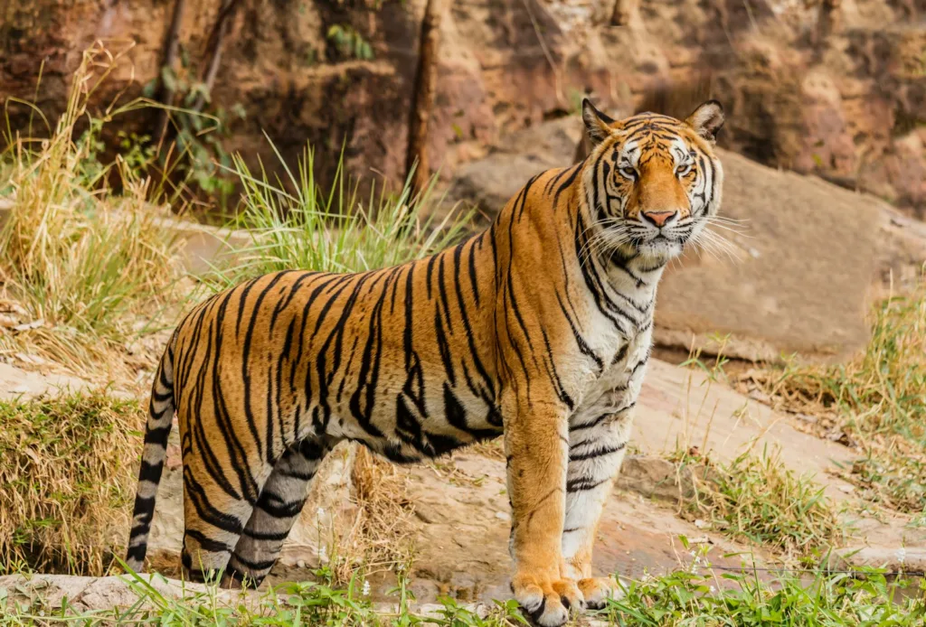
Big cats (tigers/leopards): re-ID + corridor protection
Species/region: Tigers and leopards across fragmented forest landscapes
Problem: Hard to estimate population trends and protect movement corridors as roads and farms expand
Data source: Camera traps, satellite habitat layers, road networks, incident reports
AI method:
- computer vision for species ID and individual re-ID
- spatial modeling for corridor likelihood and fragmentation risk
- On-the-ground action:
- place new cameras where models show uncertainty or corridor pinch points
- focus anti-snare sweeps along high-risk edges
- prioritize restoration or conflict mitigation where corridors are breaking
- Measurable result/learning:
- faster processing of camera trap data, more consistent ID over time
- earlier detection of occupancy changes in key zones
- better justification for corridor protection based on repeatable evidence
Elephants and rhinos: movement analytics + risk hotspots
Species/region: Elephants and rhinos in high-conflict or high-poaching risk areas
Problem: Poaching risk and conflict incidents are spatially clustered and change fast
Data source: GPS collar tracks (where appropriate), past incident locations, terrain, access routes, satellite change alerts
AI method:
- anomaly detection for unusual movement stops or clustering
- risk mapping using environmental and human-access predictors
- On-the-ground action:
- prioritize patrols near access points and high-risk corridors
- trigger welfare checks when movement patterns indicate possible distress
- coordinate with communities on conflict hotspots (water points, crop edges)
- Measurable result/learning:
- improved patrol allocation efficiency (same teams, better coverage)
- faster response to potential incidents (with careful verification)
- stronger internal learning about which predictors actually matter
Ethical framing matters here. Telemetry data can expose animals if mishandled. Strong programs treat location data like sensitive intelligence: access control, encryption, redaction, delayed sharing.
Marine species (whales/turtles): acoustics and vessel-risk modeling
Species/region: Whales in shipping corridors; turtles on nesting beaches and migration routes
Problem: Vessel strikes, noise, and bycatch risk; limited ability to monitor presence in open water
Data source:
- passive acoustic monitoring (PAM) for whale presence
- AIS vessel traffic data
- habitat layers (depth, temperature, productivity)
- drones or beach imagery for nesting monitoring where permitted
- AI method:
- call detection and classification for presence signals
- vessel-risk models combining traffic + habitat + seasonal presence
- On-the-ground action:
- dynamic advisories or routing recommendations in higher risk zones
- targeted enforcement or outreach with shipping operators
- improved timing of beach protection based on nesting activity signals
- Measurable result/learning:
- better leading indicators of presence in time and space
- clearer risk maps to justify mitigation measures
- faster detection of seasonal shifts (which is becoming common with warming seas)
A note: drones on nesting beaches can help, but they can also disturb wildlife if flown poorly. Permits, altitude rules, and operator training are not optional details.
The hard parts: data, bias, costs, and field reality
This is where most glossy articles stop. But this is the part that determines whether AI helps or becomes another abandoned dashboard.
Data quality is messy
- mislabeled images and audio
- sensor failures and corrupted files
- seasonal effects (rain, foliage density, migration)
- missing metadata
AI can amplify messy data if you do not build a labeling workflow and basic quality checks.
Bias is everywhere
Models often overperform in well-funded parks and underperform in community lands or less studied regions. Species and geography imbalance becomes a fairness issue, and a conservation effectiveness issue.
Connectivity and power are real constraints
Offline-first design, edge inference, solar charging, and store-and-forward workflows are what make projects survive past pilot stage.
Budget reality: total cost of ownership
Hardware is only the start. You also pay for:
- training field teams and analysts
- maintenance and replacements
- cloud compute and storage
- software updates
- travel and logistics to retrieve devices
- long-term data stewardship
Model drift and “domain shift”: why accuracy drops in new places
Domain shift, simply: the world changes, or the model moves.
- Different lighting.
- Different vegetation.
- Different camera angles.
- Different animal behavior.
Suddenly the model that was “95 percent accurate” becomes unreliable.
Mitigation looks like:
- fine-tuning with local data
- building calibration sets per region and season
- continuous evaluation, not one-time validation
Operational guardrails help too:
- confidence thresholds (only auto-label above X)
- escalation rules (uncertain alerts require human confirmation)
- periodic audits to catch drift early
Security and ethics: protecting animals, people, and sensitive locations
Sensitive data risks are not theoretical:
- telemetry can reveal targets to poachers
- nesting sites can be exposed
- community surveillance concerns can damage trust and safety
Safeguards that should be standard:
- role-based access control
- encryption at rest and in transit
- redaction of coordinates in shared outputs
- delayed public release of sensitive detections
- clear data-sharing agreements and consent processes
Ethical deployment is not a paragraph at the end. It includes:
- consent and transparency with communities
- benefit-sharing (jobs, training, infrastructure, decision power)
- local stewardship and governance
- avoiding tech solutionism, the “we installed sensors so we did conservation” trap
How to choose the right AI approach for a conservation project (a practical framework)
If you are involved in a conservation project and you are thinking about AI, start here.
1) Start with the decision, not the model
Ask: What action will change if the AI is right?
- Will patrol routes change?
- Will camera placement change?
- Will restoration sites change?
- Will policy enforcement trigger?
If the answer is “not sure,” pause. You might be building a report generator, not a conservation tool.
2) Pick the minimum viable data
Match the method to habitat and species:
- Dense forest, elusive mammals: camera traps + vision, maybe acoustics
- Open savanna: drones + thermal, camera traps at water points
- Coast/ocean: acoustics + vessel data + habitat layers
- Rivers: eDNA + targeted surveys
3) Define success metrics early
Pick a mix of technical and operational metrics:
- precision/recall for detections (and per species, not just average)
- time saved in labeling and review
- response time from alert to verification
- number of habitat-loss alerts confirmed
- confidence in population trend estimates (uncertainty bounds)
4) Deployment checklist (the unsexy stuff)
- permits (drones, tagging, protected areas)
- community partners and governance agreements
- training and handover plans
- maintenance schedule and spare parts
- incident response plan (what happens when an alert fires?)
5) Build a feedback loop
- labeling workflow (who reviews uncertain cases?)
- error reviews (why did we miss that? why did we false-alarm?)
- iteration cadence (monthly? quarterly?)
- documentation so knowledge stays when staff changes, which they always do
What’s next in 2026–2028: where smart conservation technology is heading
A few trends are already pretty clear.
- More edge-native systems: solar-powered sensors, on-device filtering, mesh networking in remote parks.
- Multimodal conservation models: satellite + acoustics + camera traps + ranger notes combined into stronger signals, fewer false alarms.
- Real-time habitat accountability: automated change alerts linked to enforcement workflows and policy reporting, not just research papers.
- Interoperability push: shared datasets, open standards, reproducible benchmarks so teams stop rebuilding the same pipeline from scratch.
- A realistic note: progress depends as much on governance, funding, and community leadership as on algorithms. Probably more.
Conclusion: AI can’t save species alone but it can change the odds
The most defensible benefits of AI in wildlife conservation in 2026 are not flashy. They are practical:
- faster monitoring
- earlier threat detection
- better prioritization of limited people and money
- measurable learning cycles so interventions improve over time
The balanced truth is also the only useful one: AI plus experts plus communities plus policy is the winning combination. Without the last three, AI becomes a gadget.
If you are starting from scratch, the best approach is usually: start small, prove value, protect data, then scale what works. Keep humans in the loop. And keep the work grounded in what conservation actually is. People protecting places, over years, with patience and grit. AI just helps them see sooner.
Frequently Asked Questions
By 2026, wildlife conservation faces escalating pressures like rapid habitat loss, climate-driven range shifts, organized wildlife crime, and underfunded field teams covering vast landscapes. Concurrently, advancements such as cheaper sensors, improved satellite revisit rates, edge AI on devices, multimodal models combining images, audio, and text, and better low-connectivity deployments have made AI a practical tool to detect threats earlier, monitor populations more accurately, and stretch limited conservation budgets.
AI in wildlife conservation typically involves three key components: 1) Data Collection using camera traps, drones, satellites, acoustic recorders, GPS collars, eDNA sampling, and citizen science; 2) Modeling through machine learning algorithms that identify species presence, detect threats like chainsaws or abnormal animal movements; and 3) Action where insights translate into alerts for ranger teams, patrol planning maps, habitat restoration targeting, corridor decisions, and impact evaluations after interventions.
Machine learning (ML), including deep learning and computer vision techniques, processes vast amounts of raw data such as images and audio to make predictions like identifying species (e.g., leopards), detecting threat sounds (e.g., chainsaws), spotting forest loss events promptly, or recognizing abnormal animal movement patterns. This enables faster decision-making that supports timely conservation actions rather than just retrospective documentation.
No. AI supports but does not replace ecological expertise, Indigenous knowledge, community-led stewardship, or the political processes vital for protecting land and water. If a solution claims otherwise, it is usually a warning sign. Effective conservation blends AI-driven insights with human judgment and local engagement to create meaningful impact.